
Dwarahat, India: Temples, YSS Ashram, Babaji Cave & Local Travel Guide
Dwarahat is a quiet Kumaon town known for old stone temples, pine-covered hills, a spiritual atmosphere and access to the Dunagiri region. If you are searching for Dwarahat Uttarakhand, Dwarahat YSS Ashram, Mahavatar Babaji’s Cave, Pandavkholi or road distances from Ranikhet, Almora, Nainital and Rishikesh, this guide brings the main information together.
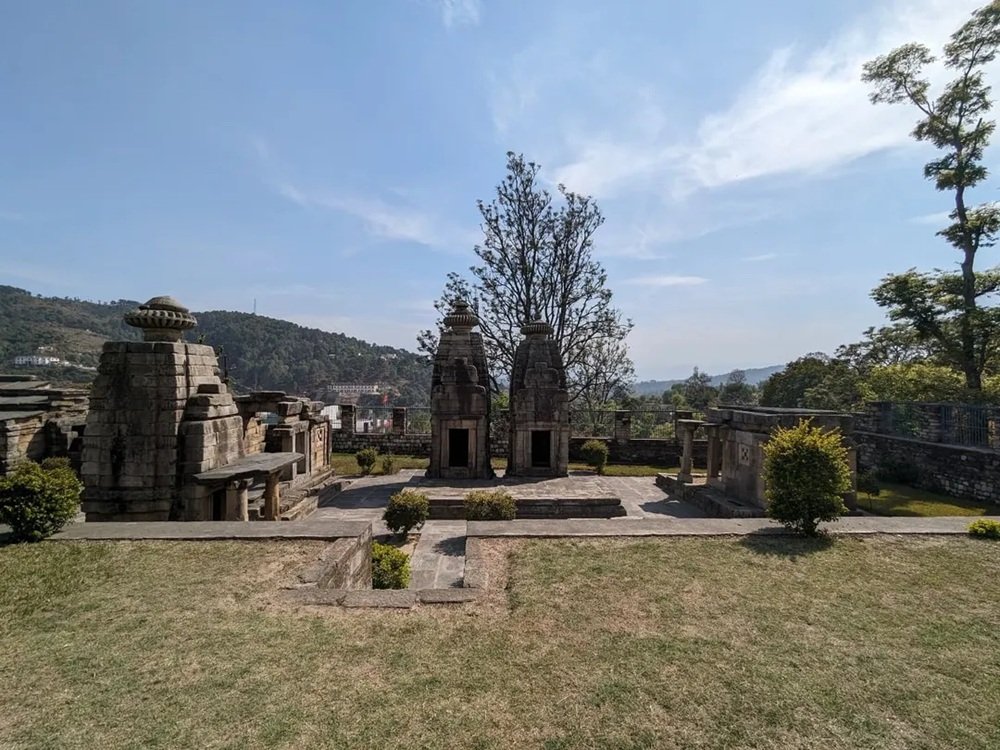
Welcome to Dwarahat, Uttarakhand
Dwarahat is in Almora district in the Kumaon region of Uttarakhand, India. It is not a big city with hurried traffic and rows of large hotels. It is a small hill town where the market, temple lanes, nearby villages and mountain roads shape the rhythm of the day. In the morning, the hills feel fresh; in winter, the air can be sharply cold; and after rain, the surrounding slopes look green and clear.
People come to Dwarahat for different reasons. Some visit the historic Dwarahat temples; some come to the Yogoda Satsanga Society of India (YSS) ashram; others use the town as a base for Dunagiri Mata Temple, Kukuchina, Mahavatar Babaji’s Cave and Pandavkholi. Travellers also stop here while exploring Ranikhet and other parts of Kumaon.
The best way to enjoy the area is not to rush through every place in one day. Allow time for temple complexes, mountain roads and the final walk to the cave. Distances in the hills may look short on a map, but bends, gradients, weather and road works can make the drive slower than expected.
Dwarahat Quick Facts
Essential information for planning a first visit to Dwarahat India.
Location
Dwarahat town, Almora district, Kumaon, Uttarakhand, India.
Height Above Sea Level
Approximately 1,500 metres (around 4,920 feet). Elevation varies across nearby hills and villages.
Known For
Historic temples, YSS Dwarahat Ashram, Kumaoni hill scenery and access to Dunagiri and Babaji Cave.
Nearby Town
Ranikhet is a useful nearby reference point for travellers approaching Dwarahat.
Landscape
Mountain valleys, forested slopes, villages, temple sites and winding Kumaon roads.
Trip Style
Heritage temples, meditation, spiritual travel, short hikes and a slower Kumaon road trip.
Elevation and road distances are approximate. Confirm exact locations and current conditions before travelling.
Where Is Dwarahat in India?
Dwarahat lies in the Kumaon Himalayas of Uttarakhand, in Almora district. Ranikhet is a useful nearby reference town, while Almora, Nainital, Kathgodam and Haldwani connect travellers to wider Kumaon routes. The town is also an access point for the Dunagiri area and the spiritual destinations around Kukuchina.
The phrase Dwarahat range is often used by travellers when describing the hills around Dwarahat, Dunagiri and the Babaji Cave route. It is useful as a broad travel description, but should not be assumed to name one formally bounded mountain range. For navigation, search the exact destination—Dwarahat town, YSS Ashram, Dunagiri Temple, Kukuchina or Mahavatar Babaji Cave.
For district context and nearby attractions, see the Almora district tourism information.
Dwarahat Height From Sea Level
Dwarahat is approximately 1,500 metres (about 4,920 feet) above sea level. Figures can vary between travel websites because the town, nearby villages, temple sites and mountain slopes are not all at the same elevation.
The elevation gives Dwarahat a mountain climate. Summer days are often more comfortable than the plains, while winter mornings and evenings can be very cold. Rain and cloud can change visibility quickly, and higher trails around Dunagiri and Pandavkholi may feel colder and more exposed than the town market.
What to Wear
Carry layers, a warm jacket for early mornings, comfortable walking shoes and rain protection when showers are possible.
Before a Mountain Walk
Check the forecast and ask locally about mud, slippery stones, water availability, fog and trail access.
Dwarahat Temple: The Ancient Temple Town
Dwarahat is known for historic stone temple groups and the architectural heritage of Kumaon.
Explore the Dwarahat Temple Groups
Dwarahat’s stone shrines are an important reason to stop in town rather than driving straight through. Look at the masonry, carved details and the way the temples sit within the settlement. Respect worshippers and avoid climbing on fragile structures.
How to Visit the Temples Respectfully
- Visit in daylight so temple details are easy to see.
- Dress modestly and follow local customs at active shrines.
- Ask before photographing people or restricted interiors.
- Do not touch, scratch or climb on old stonework.
- Leave enough time for more than one temple complex.
The district’s overview of places of interest in Almora includes Dwarahat and other regional heritage destinations.
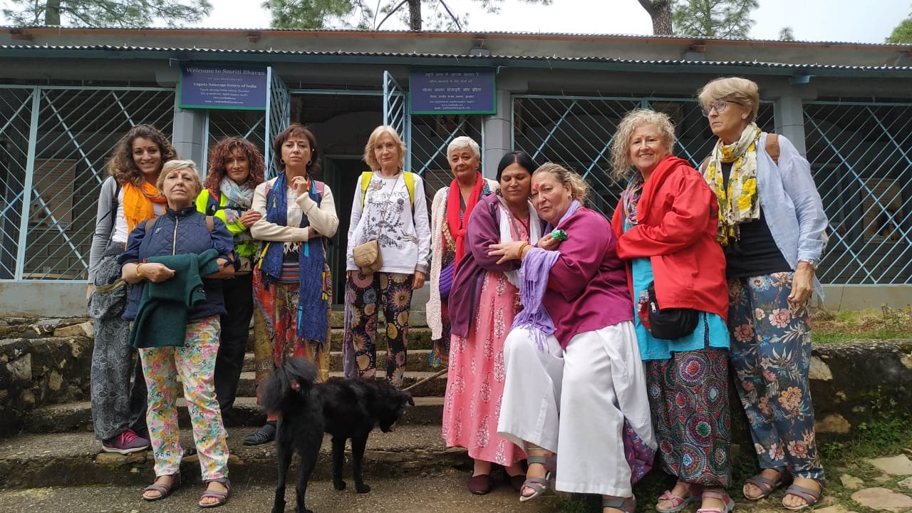
Dwarahat YSS Ashram: Yogoda Satsanga Sakha Ashram
The Dwarahat YSS Ashram is associated with the Yogoda Satsanga Society of India, the organisation connected with the teachings of Paramahansa Yogananda. It is an important destination for visitors interested in meditation, spiritual study and the Kriya Yoga tradition.
Official YSS information places the ashram around 1.5 km from Dwarahat town, surrounded by pine forest. Accommodation and retreat participation are subject to the ashram’s rules, eligibility and availability. Contact the ashram directly before making plans.
For current information: Official YSS Dwarahat Ashram page · visiting hours.
Mahavatar Babaji’s Cave, Dwarahat Range, Uttarakhand
Plan the cave visit as a mountain excursion, not simply as a stop beside the main road.
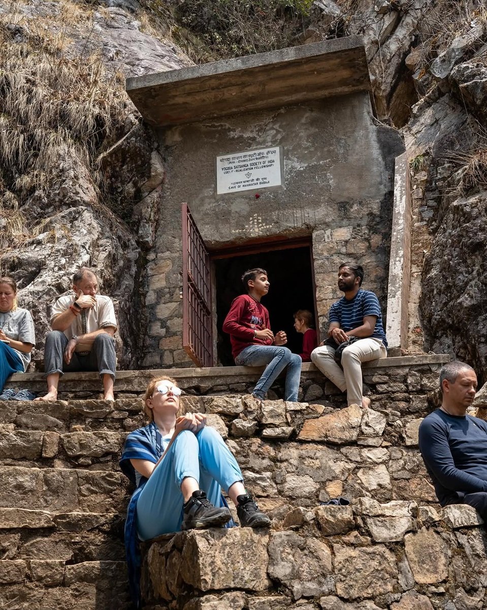
Mahavatar Babaji Cave
The cave is traditionally associated with Mahavatar Babaji and the Kriya Yoga tradition. Pilgrims commonly combine the visit with Dwarahat, the YSS Ashram or Dunagiri, depending on their schedule and the day’s conditions.
Dwarahat to Babaji Cave Distance
The journey from Dwarahat towards Kukuchina and the cave access area is a regional mountain drive, followed by a final approach on foot. The exact road distance depends on the starting point, selected road and where a vehicle can reach.
Before You Go
- Start early enough to complete the walk in daylight.
- Wear shoes with reliable grip; the trail may be uneven or slippery.
- Carry water, a light layer and rain protection as appropriate.
- Do not assume mobile signal, shops or refreshments will be available along the route.
- Respect the site’s spiritual significance and keep the area clean and quiet.
Explore Babaji Cave tour options or read the Babaji Cave trek guide.
Dwarahat to Kukuchina and Dunagiri Mata Temple
Dunagiri Mata Temple is one of the region’s well-known hill shrines. The drive from Dwarahat towards Dunagiri and Kukuchina takes you through Kumaon countryside, with winding roads and changing views as the terrain rises and falls.
Kukuchina is an important approach area for travellers visiting Mahavatar Babaji’s Cave. Do not confuse the village/road approach with the cave itself: reaching the area by vehicle does not mean the final walk is complete.
The Almora district tourism page describes Dunagiri Temple as roughly 10 km from Dwarahat, but the actual route and driving distance depend on the exact destination pin and approach road. Check local directions before departure.
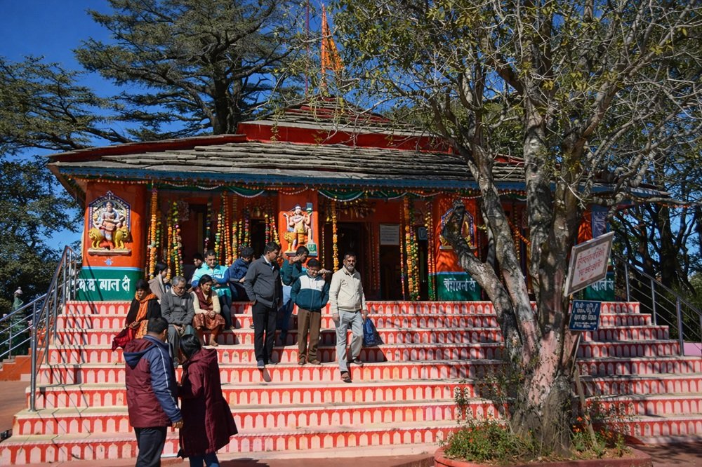
Dwarahat to Pandavkholi: What Travellers Should Know
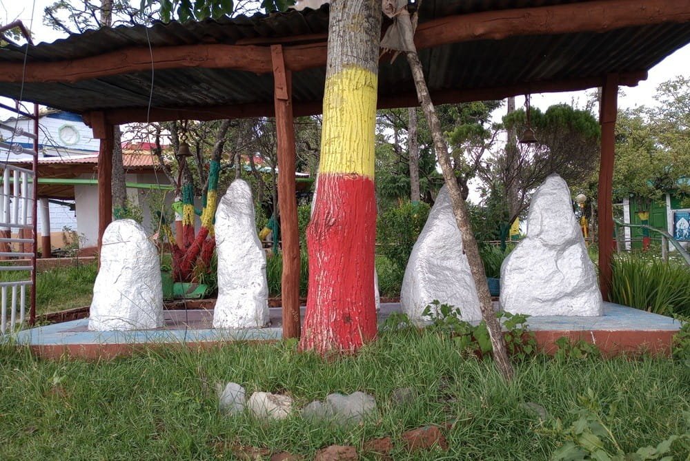
Pandavkholi, also written Pandukholi, is a mountain destination in the wider Dunagiri region. Travellers visit for the highland setting, walking routes and spiritual atmosphere. Depending on the route, reaching the destination may involve a drive followed by a trek.
There is no single useful road-distance figure for every visitor because the route can vary with the trailhead and the point you intend to reach. Confirm the starting point, walking time, gradient, weather and local access before planning a same-day return.
- Use sturdy footwear and carry enough water.
- Allow extra time for uphill walking and rest breaks.
- Avoid starting late in the afternoon.
- Ask locally whether the trail is muddy, slippery or affected by recent weather.
Dwarahat Distance Chart: Road Distances to Nearby Places
Use this chart for early itinerary planning. Distances are approximate road estimates, not live navigation results.
| Route | Approximate road distance | Planning note |
|---|---|---|
| Dwarahat to Ranikhet | 30–35 km | Nearby-town route; allow for hill-road driving. |
| Ranikhet to Dwarahat | 30–35 km | Varies with exact start and route. |
| Dwarahat to Almora | 70–80 km | Check the route selected by your driver or map app. |
| Almora to Dwarahat | 70–80 km | Allow extra time for curves and slower traffic. |
| Dwarahat to Nainital | 85–100 km | Route depends on the Kumaon road network and endpoints. |
| Nainital to Dwarahat | 85–100 km | Allow extra time during holidays and rain. |
| Dwarahat to Dehradun | Approx. 300–360 km | Long intercity drive; route and traffic make a difference. |
| Dwarahat to Rishikesh | Approx. 270–330 km | Check the current foothill and mountain route. |
| Rishikesh to Dwarahat | Approx. 270–330 km | Best planned as a substantial travel day. |
| Dwarahat to Dunagiri Mata Temple | About 10 km in district tourism information | Exact distance depends on destination pin and road approach. |
| Dwarahat to Kukuchina | Verify exact route | Use the exact village/road destination in navigation. |
| Dwarahat to Mahavatar Babaji Cave | Road access + final walk | Confirm the current vehicle drop-off point and trailhead. |
| Dwarahat to Pandavkholi | Route and trek dependent | Confirm the trailhead, walking time and conditions. |
| Dwarahat to Kainchi Dham | Approx. 80–110 km | Depends on route and exact ashram entrance. |
| Kainchi Dham to Dwarahat | Approx. 80–110 km | Check traffic around Bhowali and nearby hill roads. |
| Kasar Devi to Dwarahat | Approx. 65–85 km | Depends on the exact Kasar Devi starting point. |
| Dwarahat to Badrinath | Long inter-region journey | Plan using current road route, season and pilgrimage traffic. |
| Dwarahat to Kedarnath | Road journey + onward trek/transfer | Kedarnath is not a direct drive-to-temple destination. |
These ranges are planning estimates, not guaranteed distances. For remote destinations such as Babaji Cave and Pandavkholi, consider the roadhead and walking section separately.
Rishikesh to Dwarahat Distance: How to Plan the Journey
The Rishikesh to Dwarahat distance should be checked with your exact starting point and destination. For general planning, allow for a long road journey of several hours and avoid tight same-day commitments such as arriving late and immediately starting the Babaji Cave trek.
Travellers may approach Kumaon through the foothills and continue along winding mountain roads towards Ranikhet and Dwarahat. The route can change due to traffic, road works, weather or other local conditions.
Suggested travel approach
- Start early from Rishikesh. Keep a flexible schedule for traffic and meal breaks.
- Reach Dwarahat and settle in. Avoid adding a strenuous trek after a long drive if possible.
- Visit the cave the next day. Start early and confirm the trail condition locally.
Rishikesh to Dwarahat: Quick Tips
- Confirm the approximate road distance on the day of travel.
- Ask your driver about fuel, meal and restroom stops.
- Carry personal medication and any motion-sickness essentials you need.
- Keep a warm layer handy even if Rishikesh is warm when you leave.
- Save your accommodation location offline in case mobile data becomes unreliable.
Nainital to Dwarahat, Kainchi Dham and Kasar Devi
These places can be combined into a broader Kumaon trip, but each stop deserves realistic travel time.
Kainchi Dham to Dwarahat
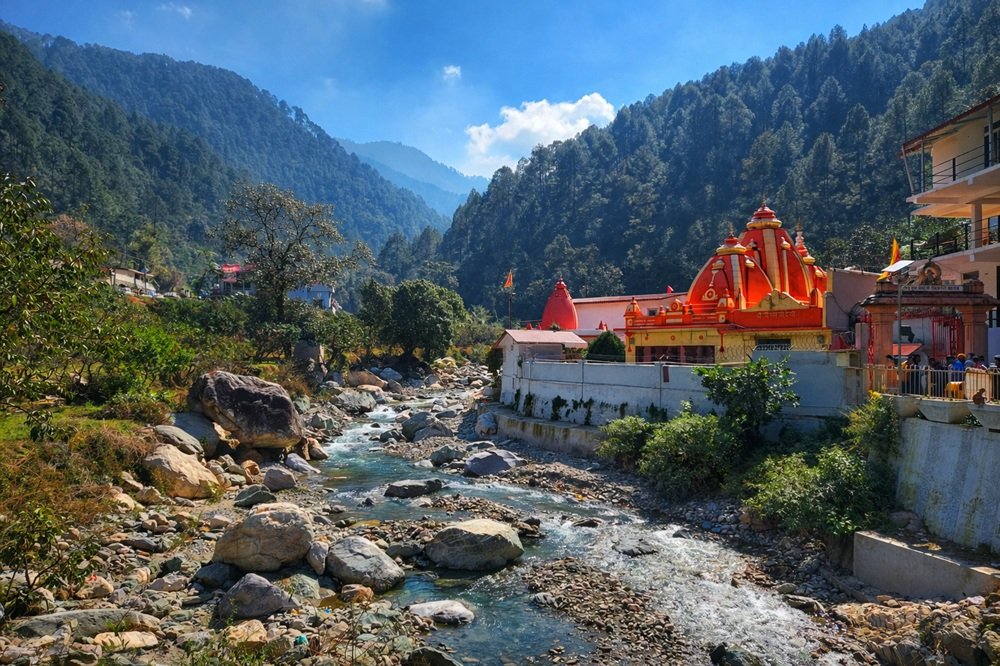
Kainchi Dham is a popular spiritual stop associated with Neem Karoli Baba. The road journey to Dwarahat is route-dependent; check the current map estimate and ashram visitor guidance before setting off.
Kasar Devi to Dwarahat
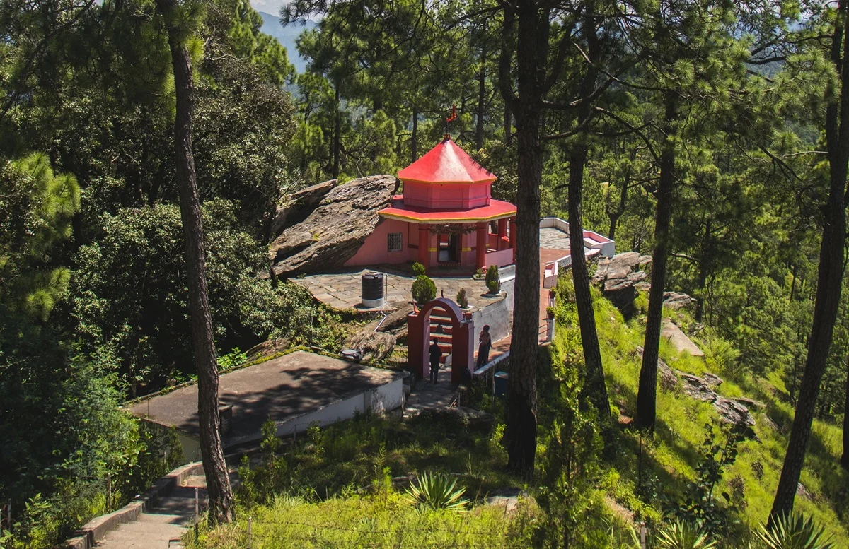
Kasar Devi is near Almora and is known for its temple and hillside views. Travellers continuing to Dwarahat should allow time for the Kumaon hill roads and check the exact distance from their accommodation.
Distance Between Nainital and Dwarahat
The Nainital to Dwarahat road journey is commonly estimated at roughly 85–100 km, depending on route and endpoints. The drive can take longer during holiday periods or poor weather, so check live navigation before travelling.
If you are planning Nainital, Kainchi Dham, Kasar Devi and Dwarahat in one itinerary, avoid trying to fit every stop into one rushed day.
Dwarahat to Kedarnath Distance and Dwarahat to Badrinath Distance
Kedarnath and Badrinath are in a different part of Uttarakhand from Dwarahat. These are not short side trips from the Kumaon hills. Total road distance depends on route, road openings, traffic, seasonal restrictions and the exact start and end points.
For Kedarnath, the journey includes road travel to the relevant base area and an onward trek or officially permitted transfer arrangement. For Badrinath, the route follows the Himalayan road network towards Garhwal. Check current official pilgrimage guidance, weather alerts and road status before finalising either trip.
Dwarahat to Kedarnath
Plan as a separate multi-stage pilgrimage. Confirm the current roadhead, trek arrangements, registration requirements and weather.
Dwarahat to Badrinath
Check the current route and road conditions. Do not rely on a single generic kilometre figure for a mountain journey.
Best Time to Visit Dwarahat
Weather and road conditions matter more than a fixed calendar promise.
Spring
A pleasant period for temple visits and countryside drives, although temperatures vary by altitude.
Summer
Often more comfortable than the plains, but check holiday traffic and book accommodation ahead where needed.
Monsoon
Green landscapes, but rain can cause slippery trails, landslides and delays. Check road advisories before travelling.
Autumn
Often suitable for scenic drives and walking when local weather is stable; still confirm the forecast.
Winter
Expect cold mornings and nights. Higher routes may be affected by frost, fog or snow depending on conditions.
For Babaji Cave
Choose dates with a safe walking window, check the trail locally and avoid starting late in the day.
Suggested Dwarahat Travel Itineraries
Use these as flexible outlines and adjust them to current access, your pace and the places you most want to see.
One Day in Dwarahat
- Explore selected Dwarahat temple groups.
- Walk through local market lanes.
- Visit the YSS Ashram only after confirming visitor guidance.
- Stay overnight if continuing to the cave next day.
Two Days: Dwarahat & Babaji Cave
- Day 1: Reach Dwarahat, settle in and visit local temples.
- Day 2: Start early for the Kukuchina/Babaji Cave route.
- Confirm trailhead, walking time and return plan in advance.
Three Days: Kumaon Spiritual Circuit
- Day 1: Dwarahat temples and YSS Ashram arrangements.
- Day 2: Babaji Cave and/or Dunagiri, subject to conditions.
- Day 3: Continue towards Ranikhet or another Kumaon stop.
Practical Tips for Visiting Dwarahat
- Cash: Carry some cash for small purchases and rural stops.
- Connectivity: Download maps and save accommodation details before leaving larger towns.
- Transport: Agree on the pickup point, waiting time and return arrangement with your driver.
- Footwear: Wear comfortable shoes for uneven temple grounds and mountain trails.
- Respect: Follow rules at ashrams and temples and ask before photographing people.
- Waste: Carry wrappers and bottles back with you.
- Safety: Do not attempt an unfamiliar trail in poor visibility or after dark.
What to Pack for Babaji Cave and Pandavkholi
- Sturdy walking shoes with good grip
- Drinking water and a small snack
- Light rain jacket and warm layer
- Sun protection and personal medicines
- Charged phone and offline map
- Small bag for carrying waste back
Frequently Asked Questions About Dwarahat India
Short answers to common searches about Dwarahat, its ashram, nearby places and road distances.
Where is Dwarahat in India?
Dwarahat is a town in Almora district in the Kumaon region of Uttarakhand, northern India.
What is the height of Dwarahat from sea level?
Dwarahat is approximately 1,500 metres, or about 4,920 feet, above sea level. Elevation differs across the surrounding hills and villages.
What is Dwarahat famous for?
Dwarahat is known for historic temple groups, YSS Dwarahat Ashram, Kumaon scenery and access towards Dunagiri, Kukuchina, Mahavatar Babaji’s Cave and Pandavkholi.
Where is the Dwarahat YSS Ashram?
The Yogoda Satsanga Sakha Ashram is around 1.5 km from Dwarahat town according to the official YSS location page. Check YSS’s official page for directions and visit arrangements.
What is the Dwarahat to Ranikhet distance?
Allow approximately 30–35 km by road as an initial estimate. The exact distance depends on your start and destination points and selected route.
What is the distance between Nainital and Dwarahat?
A practical planning estimate is around 85–100 km by road. Confirm the live route before travelling, especially during holidays and monsoon.
What is the Rishikesh to Dwarahat distance?
It is a long intercity road journey. Route estimates can vary, so check a current map with exact endpoints and allow a flexible travel day.
How far is Dwarahat from Dehradun?
Depending on the selected road route, the journey is roughly 300–360 km. Check live navigation and current road conditions before departure.
How far is Dwarahat from Babaji Cave?
The journey involves road travel towards the Kukuchina access area and a final walk to the cave. Confirm the current vehicle drop-off point and trail conditions locally.
How far is Dwarahat from Dunagiri Temple?
Almora district tourism information describes Dunagiri Temple as roughly 10 km from Dwarahat. The actual drive depends on the exact starting point and approach.
Can I visit Dwarahat, Babaji Cave and Pandavkholi in one day?
It may be too rushed, particularly if you need to drive to a trailhead and walk uphill. Check local trail conditions and walking times, and consider allowing more than one day.
What is the distance from Dwarahat to Kedarnath or Badrinath?
Both are long journeys into the Garhwal Himalayas, and Kedarnath requires an onward trek or permitted transfer from its roadhead. Plan these as separate trips and check official seasonal information.
Is Dwarahat called the Dwarahat range?
“Dwarahat range” is used informally in some travel searches to describe the surrounding hill area. For navigation, use the exact destination name and map pin.
Useful Official Travel References
- Almora district: places of interest — district context and information about Dwarahat and Dunagiri.
- YSS Dwarahat Ashram — official location and visitor information.
- YSS Dwarahat visiting hours — check the current schedule before visiting.
Road distances in this article are approximate planning guidance and should be verified before travel.
Planning a Dwarahat and Babaji Cave Journey?
If you would like to combine Dwarahat, the YSS Ashram, Dunagiri, Kukuchina and Mahavatar Babaji’s Cave, plan around your dates, walking ability and current mountain conditions. Confirm transport and trail arrangements before setting out.